Larapinta Trail Highlights
A hike along the Larapinta Trail, which spans 223km across the West MacDonnell Ranges, will showcase some of the most popular natural attractions in the Central Australia, and the Northern Territory.
Below is a list of popular points of interest along the Larapinta Trail.
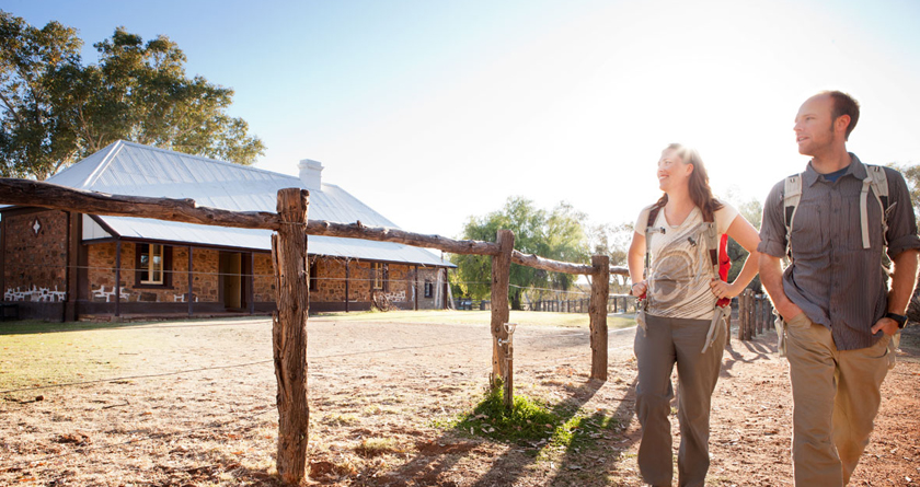
Not far from the waterhole that gave its name to Alice Springs, the Old Telegraph Station was built in 1871 as part of the 3,000km long Adelaide to Darwin Overland Telegraph Line, and is the best preserved of the 12 stations along the Overland Telegraph Line. The Alice Springs Telegraph Station Historical Reserve marks the original site of the first European Settlement in Alice Springs, and operated for 60 years before serving as a school and welfare home for Aboriginal children of mixed ancestry until 1963. Nearby is the original "Alice" spring, a semi-permanent waterhole in the Todd river, after which the Alice Springs town is named.
The Old Telegraph Station is the starting point for the Larapinta Trail, and gives an interesting insight into early European settlement in the red centre.
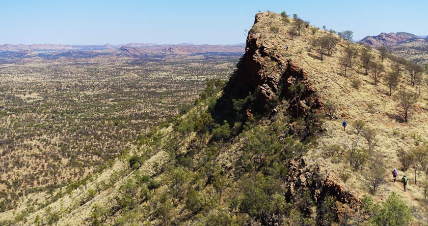
The scenic Euro Ridge (790m) provides excellent views of Alice Springs and to Mt Gillen (950m). You will approach Euro ridge in Section one, West of the Railway, up the northern flank where the land opens into scattered Mulga scrub and Wichetty Bush. Euro Ridge itself is made up of large slabs of granite tilting at 45°, and is a significant part of the aboriginal dream time legend "Mandya and Urdlu" (The Euro and the Kangaroo). This is a great spot to stop for photos, with sweeping views of Alice Springs and the West MacDonnell Ranges.
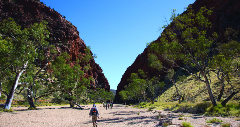
Simpson's Gap is one of the most prominent waterholes in the region and along the Larapinta Trail, set among the towering cliffs of the Simpsons Range. A site of great significance for the local indigenous Arrernte peoples, it is a location where numerous dreaming trails or song lines intersect, and was considered the home of a group of giant goanna ancestors. As you walk around Simpsons Gap, you may notice many native plants in the area, including ancient ghost gums, large stands of Mulga, and over 40 rare and unusual plants.
Simpsons Gap is also a unique gorge home to a number of species of land arid frogs. These include the Desert Tree Frogs, Spencer's Burrowing Frog, Main's Frog (also known as Sheep Frog) and the Centralian Green Frog, and if you time your visit right, you may witness these frogs after the summer rains along the walking trails.
One of the best things about Simpson's Gap is that a fantastic place for spotting black-footed rock wallabies that live on the rocky slope. Keep an eye out for these at dawn or dusk for a glimpse of them in their natural desert habitat.
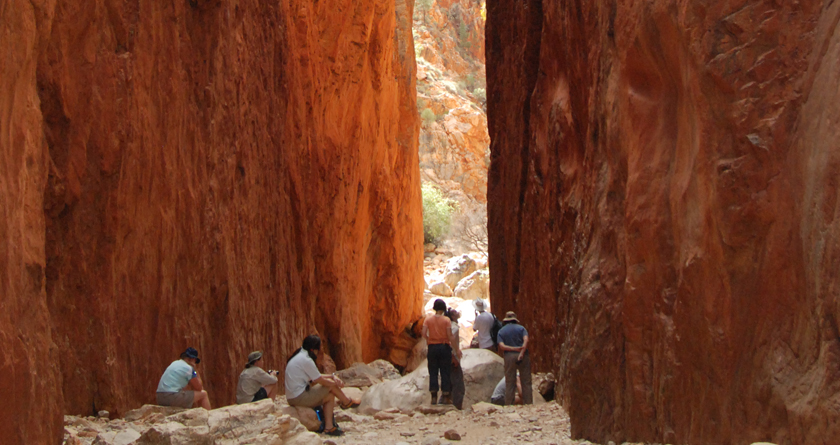
A sight to be seen, the beautiful Standley Chasm is just outside the West MacDonnell Ranges National Park, and is proudly owned and operated by its traditional landowners as part of the lwupataka Land Trust. Also known as Angkerle Atwatye to the local Indigenous people, the site's rocky slopes rise an astonishing 80 metres above the chasm, which has been carved out over millions of years by a tributary of the Finke River system – purported to be the oldest river in the world. The chasm was named after Ida Standley, Alice Spring's first school teacher and the first non-Aboriginal woman to visit this stunning place.
The best time to see the Standley Chasm is at midday, when the overhead sunlight on the chasm walls flows the walls a spectacular vibrant showing of reds and oranges. Visiting the area in the morning or afternoon can be a rewarding experience as well, as wildlife such as Black-footed Rock-wallabies are more active, feeding on grasses and cycad nuts.
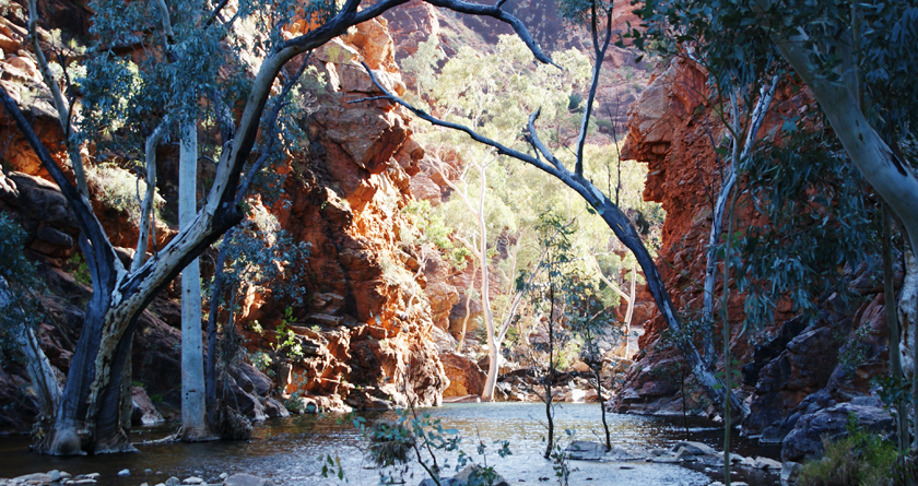
Considered an "outback Secret" due to the fact it is often overlooked by visitors in favour of other nearby destinations, Serpentine Gorge is a great place for a walk through beautiful river red gums growing alongside semi-permanent waterholes – an oasis in the arid zone! In very dry seasons, many of the surrounding waterholes dry up, leaving the Serpentine Gorge the last remaining waterhole in the area.
Serpentine Gorge is the perfect spot for quiet bird-watching and showcases the stunning geology for which the West MacDonnell Ranges are so famous. This area is a sacred site to the Western Arrernte Aboriginal people, however the dreamtime story associated with this place can only be told to initiated Aboriginal men. Highly recommended: a refreshing swim in the Serpentine Chalet Dam
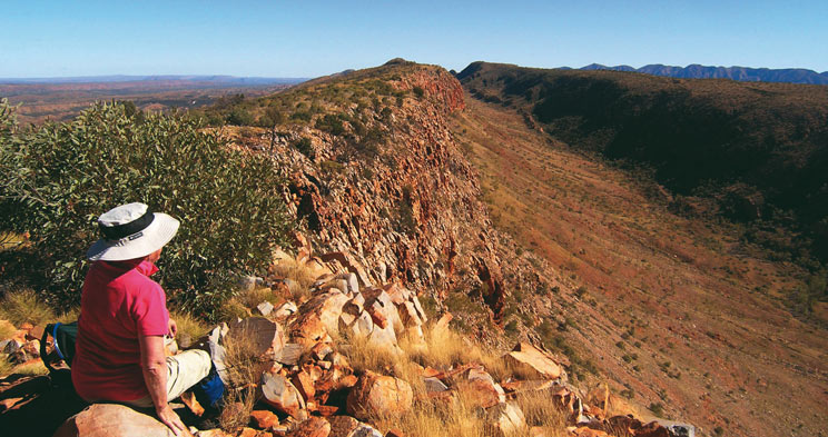
Counts point is most well known for providing one of the most classic lookouts of the whole Larapinta. Take in stunning panoramic views of Centralia’s western horizon, out past Mt Zeil and Mt Sonder and as far as the 142 million years old comet crater of Gosse Bluff. This is a spectacular opportunity to view the overall geology of the ranges, looking down the straight, high quarts ridge lines towards Mount Sonder.
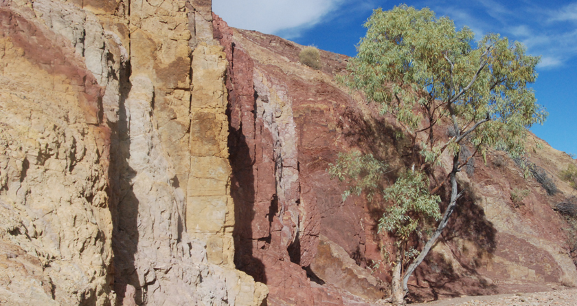
The Ochre Pits give a fascinating insight into the history of how the land was used by the indigenous Arrernte peoples (traditional owners of the West MacDonnell Ranges).
The vivid colours of the mineral ochre pits were highly sought after and mined for generations by the local Aboriginal people. Ochre was used as ceremonial body adornment, with different colours used for different purposes. White and yellow ochre were mainly used for decoration or cosmetics, alongside ash and charcoal. Mixed with water or animal fat such as emu, possum, or goanna, this paste was smeared onto the body with a feather or finger.
Red ochre in particular was traditionally combined with emu or kangaroo fat for use as a protective coating for weapons and tools. Adolescents would also be painted in red ochre as part oftheir initiation. The Ochre also played a part in traditional medicine, where ochre and eucalyptus leaves were rolled together and used as mediaction for colds. It was a custom to sing over the medicine when preparing it as it enhanced the healing powers of the ochre.
It was customary for men to dig the ochre from these pits, and due to the high quality of ochre found at this site, it became a significant commodity for trade with neighbouring nations and clans.
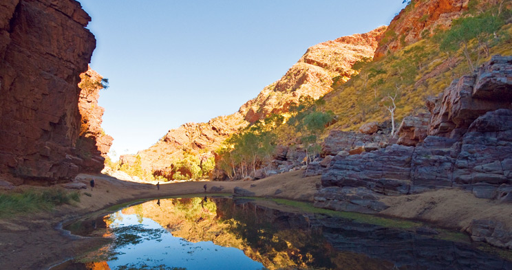
Ormiston Gorge is one of the most popular attractions in the Northern Territory, famous for its waterhole and spectacular geology that showcases the MacDonnell Ranges. With a near-permanent waterhole that is up to 14 metres deep at its southern end, and an incredible variety of flora and fauna, it is a very popular stop for swimming and taking a relaxing break out on the trail. The gorge is truly spectacular, showing off the fascinating geological features and landforms of the West MacDonnell Ranges. It is also a sacred site to the Western Arrernte people, whose dreaming story of the waterhole tells of a group of Emu's who came to the waterhole and were hunted away by a man.
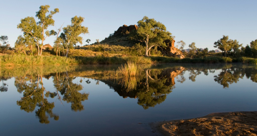
The Finke River is one of the largest in central Australia, and is said to be one of the oldest rivers in the world. Geological evidence shows that the river was formed before the surrounding ranges were pushed up during the Alice Springs Orogeny around 300-400 million years ago.
Early European explorers used the river as a path through the MacDonnell Ranges, later becoming a supply route from the south. The area is extremely rich in diversity of wildlife and rare plants, and is a great spot for birdwatching.
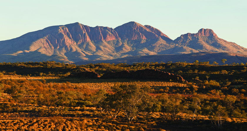
Mount Sonder (Rwetyepme) rises an impressive 1380m above the vast arid landscape, and is the fourth highest mountain in the northern territory. It can be seen from as far west along the Larapinta Trail as Ormiston Pound, and is the final destination for Larapinta Trail trekkers. The steady and exhausting climb up Mount Sonder is a good physical workout, however viewing the sunrise from the summit is an experience not to be missed and well worth the effort.
On your way up, keep an eye out for termite tunnels, the Grey-headed honey eater, the desert mouse and the Mountain Hakea - tall shrubs with bright pink flowers during September and October. While you're there, see if you can spot birds such as wedge-tailed eagles and Peregrine falcons as they soar the skies scanning for prey, or wood swallows that circle the summit and ride the thermal updroughts in search of insects.